
Airborne liDAR
The application of airborne LiDAR (Light Detection And Ranging) in forestry marks a true paradigm shift in forest resource assessment. Information outputs are comparable with conventional ground inventory but costs can be drammatically reduced. 'Wall-to-wall' maps of tree height and other statistics are also produced, allowing a precise and accurate estimate of the forest resources being assessed, whether that be for planning purposes or in a due diligence situation.
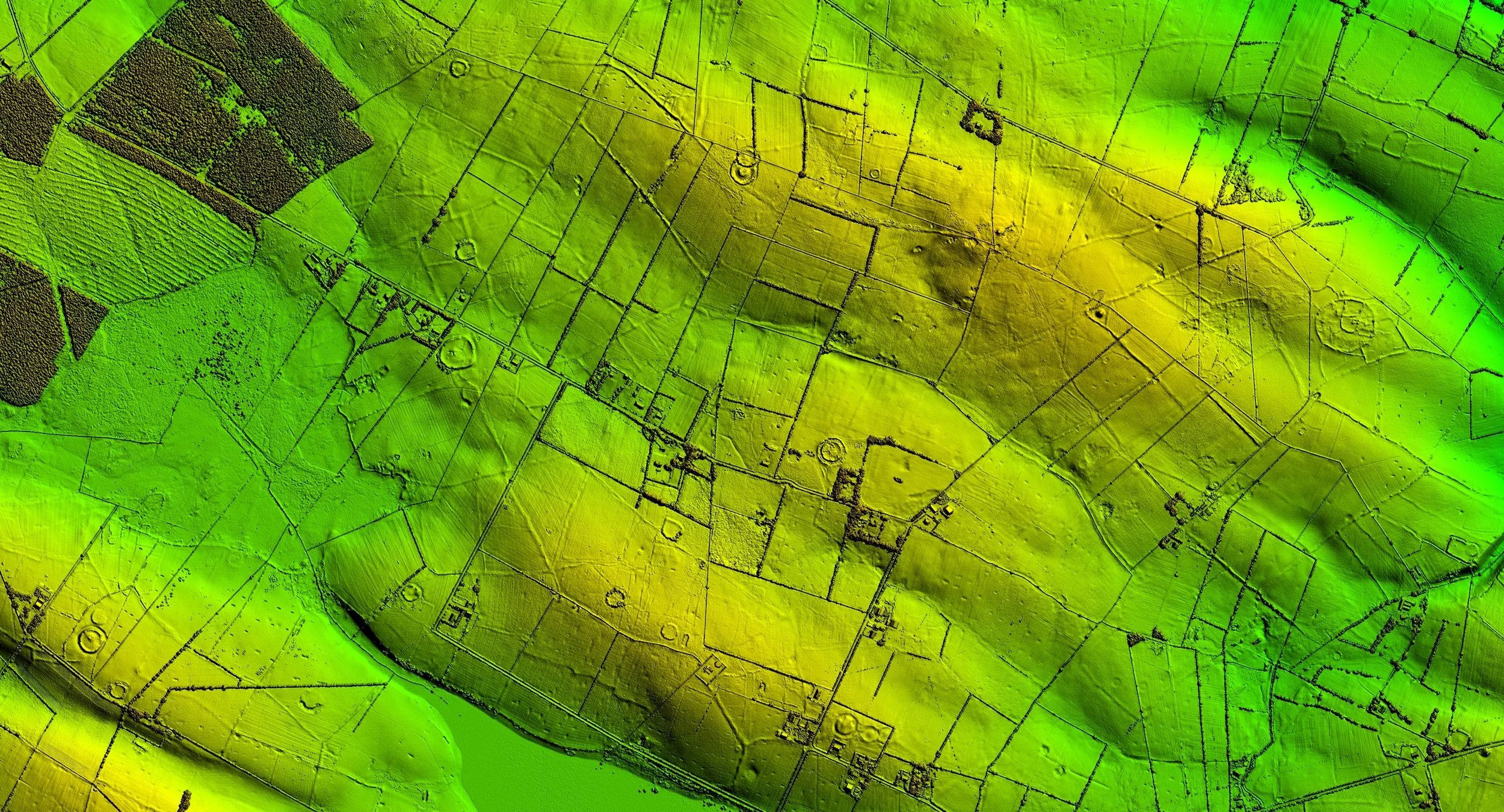
Silvalytics is now bringing LiDAR into the mainstream for forest managers in the UK and Ireland. Bluesky (who provided the LiDAR derived image shown above) is a specialist in aerial data acqusition.

Ireland's state forest company, Coillte, have run a very sucessful annual LiDAR programme with since 2011 and see significant benefits.
LiDAR introduction
We find this video from the US National Ecological Observatory Network a useful introduction to the world of Airborne LiDAR.
LiDAR Products and services WE OFFER
Basic Products:
Digital Terrain Model which is useful for harvest and roading planning. Minimise road construction costs by knowing the terrain to be crossed in high precision; know where water courses or areas of high water table are and how they should be managed; assess working slopes and hazards.
Canopy Height Model which is simply a map showing the height of the forest canopy over the whole land parcel. Re-assess Yield Class to ensure the crop is being managed to its full potential and is valued correctly and re-map sub-compartments accordingly; identify areas that need re-planting or fertilisation.
Forest inventory:
To us, LiDAR is worthwhile in forestry when it yields information that is comparable to conventional plot-based forest inventory
It is produced by combining technqiues developed by Arbonaut since 1994 with airborne LiDAR data and matching ground sample points
Outputs include
Mean DBH
Basal area per hectare
Volume per hectare
Stems per hectare
focussed planning and delivery
Silvalytics will work with clients to ensure data acquisition meets their needs and the full potential of acquired LiDAR is realised and understood by the end user. Outputs are in table or GIS format, depending on the product, and can be viewed on any GIS platform of choice and can sit side-by-side with conventional or other sources of forest inventory information.
Contact us at info@silvalytics.com to discuss your requirements.